|
|
Hiked
on: September 30, 2000
|
|
|
|
The first couple of miles hiking up Carrigain are flat with a couple of easy stream crossings. At the last crossing the trail begins to steepen and has lots of switchbacks until you get to signal ridge. |
|
 Signal Ridge Click on image for large view |
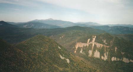
 Vose Spur from Signal Ridge Click on image for large view |
Vose Spur is one of the New England 100 highest peaks. It is completely wooded with no trails. |
|
Anthony tagged along with us on this hike. We all had a great time because the weather was warm and the views were awesome. |
 Anthony on the summit of Mt. Carrigain Click on image for large view |
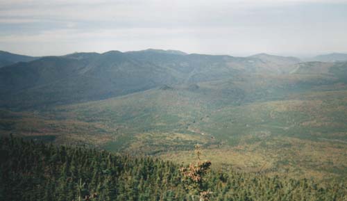
 View of Mt. Washington from Mt. Carrigain Click on image for larger view |
Mt. Carrigain is located in the geographic center of the White Mountains. Because of this it has one of the best views of any summit. |
|
The peak is completely wooded with limited views, but still has an old firetower which offers a panoramic view in all directions. |
 Mt. Carrigain with firetower from Signal ridge Click on image for larger view |
 View of the Pemi from Mt. Carrigain Click image for larger view |
The hike to the summit and back is about 10 miles, but the views are worth every step. This is another peak I want to get back to someday. |

